Mike's Point
0.5137°S 130.6744°E · reef
A small rocky islet at the eastern tip of Kerupiar Island in Raja Ampat's Dampier Strait, Mike's Point pairs cave-like grooves, overhangs and swim-throughs with strong, converging tidal current — a dramatic, current-dependent dive best left to experienced divers.
Overview
Mike’s Point is a small rocky islet in the Dampier Strait, the busy tidal corridor that separates Waigeo and Gam from Mansuar in central Raja Ampat. Operators place it at the eastern tip of Kerupiar Island, off Gam’s southeast coast, though some describe it more loosely as a pinnacle sitting between Gam and Mansuar. Above water it is unremarkable — a low outcrop with scrubby trees on top. Below, the rock drops into walls, grooves and overhangs that make it one of the strait’s more distinctive profiles.
The name is comparatively recent and well attested: dive pioneer Max Ammer is credited with naming the site after his son Mike during the early exploration of Raja Ampat.
Why divers come
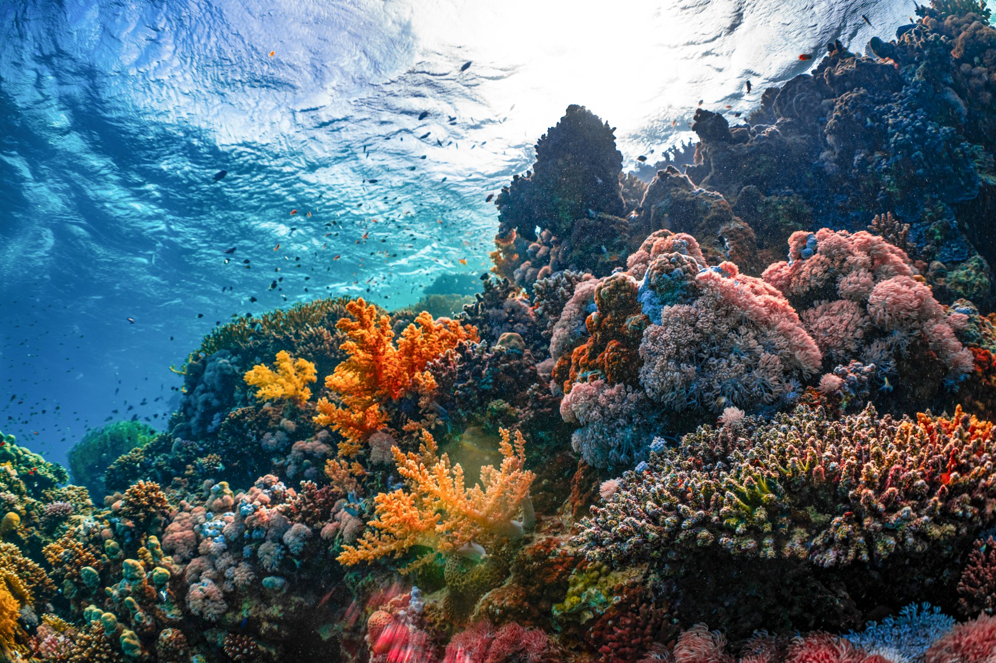
The draw is topography plus water movement. The Dampier Strait funnels flow between the Pacific and the Indian Ocean, and Mike’s Point sits directly in that stream. The result is a rock face carved with crevices, overhangs and cave-like grooves, wrapped in hard and soft coral, with current-fed schooling fish stacking up on the exposed side. It is a site that rewards good trim and good timing rather than distance covered.
The dive
Dives are typically run along the south-facing wall, which operators report continuing past 30–40 m, and up onto shallower slopes and a plateau that comes up to roughly 8 m. Most of the interest is in the upper 25–30 m, and there is little reason to go deep — the coral, the light and the fish life are all better shallow.
The signature features are the grooves and overhangs cut into the rock, plus at least one swim-through reported at around 9 m. Guides commonly position divers on the sheltered side and work the point itself in short, deliberate bursts.
The WWII bombing story
Almost every operator write-up repeats the same account: during the Second World War the islet was mistaken from the air for a camouflaged Japanese warship — the current parting around it supposedly resembling a bow wave — and bombed, and the blast damage explains the fractured rock and rubble seen today.
This should be read as durable local lore, not documented history. The sources that carry it hedge it themselves: Papua Diving says the area was “reportedly” mistaken for a Japanese ship; Meridian Adventure introduces it as “locals tell a tale.” Accounts also disagree on who did the bombing, variously “Allied planes” or “the U.S. Air Force” — an organisation that did not exist as such until 1947. No mission record, unit war diary or archival citation appears in any of the operator accounts, and general searches of New Guinea campaign material do not surface a strike on this islet.
The one piece of physical evidence offered is indirect: Raja Ampat Biodiversity reports that dive centre manager Max Finzi found a .50-calibre cartridge with a 1942 headstamp near the resort — ammunition consistent with the Browning M2 guns carried by American aircraft. That source is careful about what this shows, noting it confirms wartime activity in the area rather than proving the bombing itself. Wartime activity across this region is not in doubt; a specific airstrike on this specific rock remains unverified. Enjoy the story, but do not repeat it as fact.
Marine life
Wobbegong sharks are among the site’s more reliable finds, tucked flat beneath ledges, alongside whitetip and blacktip reef sharks. Schools of fusiliers, jacks, barracuda and yellow-striped sweetlips work the current-exposed rock, with Napoleon wrasse, Spanish mackerel and eagle rays reported. Turtles and sea snakes are more often seen shallow. The crevices are also strong macro habitat — nudibranchs, pygmy seahorses, mantis shrimp and scorpionfish are all commonly cited.
Conditions & who should dive it
This is an advanced site, and the current is the reason. Operators describe strong tidal flow that converges around the point and can turn downward when running hard. Dive Concepts states plainly that experience is required; Meridian advises against diving the peak of the current unless you are very experienced and with a guide who knows the site intimately. Most dives are planned around slack or the gentler part of the tide. Reef hook, SMB and disciplined buoyancy are appropriate. Water sits around 26–30°C year-round.
When to go
Raja Ampat is diveable year-round, but roughly October to April is the settled season, with calmer seas and good visibility; May to September can bring rain and southern winds that make the Dampier Strait choppy. Day to day, tide timing matters more than the calendar here.
Getting there
Access is by boat, from Dampier Strait resorts on Gam, Mansuar and Kri, or by liveaboard. The regional gateway is Sorong, then ferry or transfer to Waisai.
A note on protection
Raja Ampat has been designated a shark and manta ray sanctuary, declared in 2010 and backed by local regulation issued in 2012. Visitors must hold the marine park entry permit administered by the Raja Ampat MPA authority; check current fees and the separate visitor entry ticket before travelling, as amounts and procedures change.
- Mike's Point Raja Ampat — Iconic Dampier Strait's Dive — Papua Diving
- Mike's Point dive site in Raja Ampat — Dive Concepts
- Mike's Point — One of the Most Iconic Raja Ampat Dive Sites — Raja Ampat Biodiversity Eco Resort
- Mike's Point — Meridian Adventure Dive, Raja Ampat
- Entry Permits — Kawasan Konservasi Perairan di Raja Ampat (Raja Ampat MPA Authority)
- Indonesia: Raja Ampat is now a Manta & Shark Sanctuary — DivePhotoGuide
Sea-surface temperature and wave height from Open-Meteo Marine (ERA5 reanalysis, monthly averages).
282 verified species observations (129 species) logged within ~11 km of this site between 1990 and 2025, from the Ocean Biodiversity Information System.
- Acanthurus lineatus
- Ctenochaetus striatus
- Hippocampus bargibanti
- Hippocampus denise
- Hippocampus pontohi
- Pseudamia hayashii · Hayashi's Cardinalfish
- Pseudochromis fuscus · Brown Dottyback
- Cypho
- Trimma xanthum · Yellow-red Pygmygoby
- Asterropteryx
- Apogon · three-saddle cardinalfish
- Hemiscyllium
Scientific survey records skew toward sampled taxa (molluscs, corals) and do not reflect what you are guaranteed to see on a dive.
Source: OBIS (obis.org), aggregated Darwin Core occurrence records.
Conditions change with the tide and the season. If you have dived this site, share what it was actually like — date, visibility, current, and what you saw. Real, recent reports from divers are exactly what this guide is built to collect.
Send a conditions report ›